The Supreme Court of Ohio
Columbus, OH
An organized archive and digital exhibition of the art located within the Thomas J. Moyer Ohio Judicial Center.
Message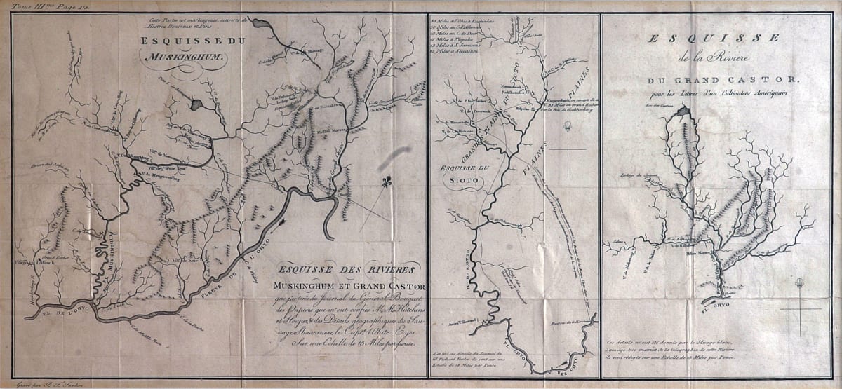
- Pierre Antoine Tardieu
- Esquisse des Rivieres Muskinghum et Grand Castor, Unknown
- Paper
- 20.25 x 9 in
This map has three sections that depict the Ohio river region and the various Native American villages in the area. It is titled “Esquisse du Muskinghum” on the left and “Esquisse de la Riviere” on the right.
- Subject Matter: Map
- Current Location: Floor 1 - Taft Map Room 108
- Collections: Maps
Other Work From The Supreme Court of Ohio