The Supreme Court of Ohio
Columbus, OH
An organized archive and digital exhibition of the art located within the Thomas J. Moyer Ohio Judicial Center.
Message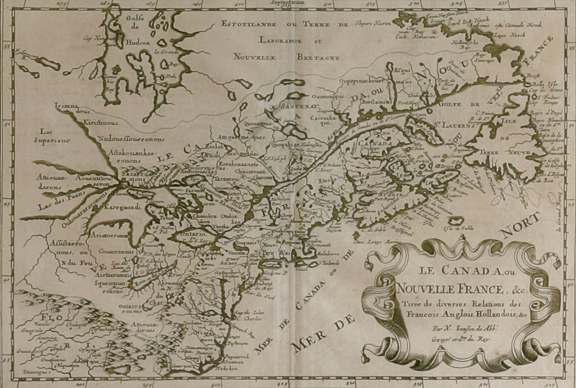
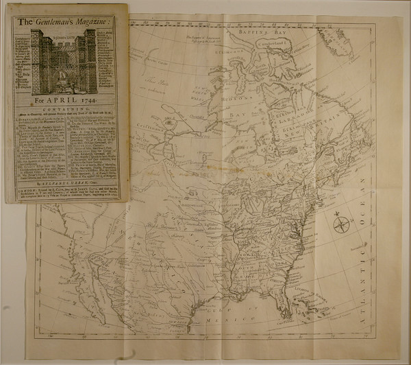
- N. Sanson/A DeWinter
- Le Canada, ou Nouvelle France, c. 1690
- Paper
- 12 x 5 in
This map depicts Canada and the Great Lakes region but Lac Superieur and Lac des Puans have no western edges. “Le Canada ou Nouvelle France, &c Tiree de diverses Relations des Francois, Anglois, Hallandois, &e.” is written in an ornamental frame on the bottom right of the paper.
- Subject Matter: Map
- Current Location: Floor 1 - Taft Map Room 108
- Collections: Maps
Other Work From The Supreme Court of Ohio