The Supreme Court of Ohio
Columbus, OH
An organized archive and digital exhibition of the art located within the Thomas J. Moyer Ohio Judicial Center.
Message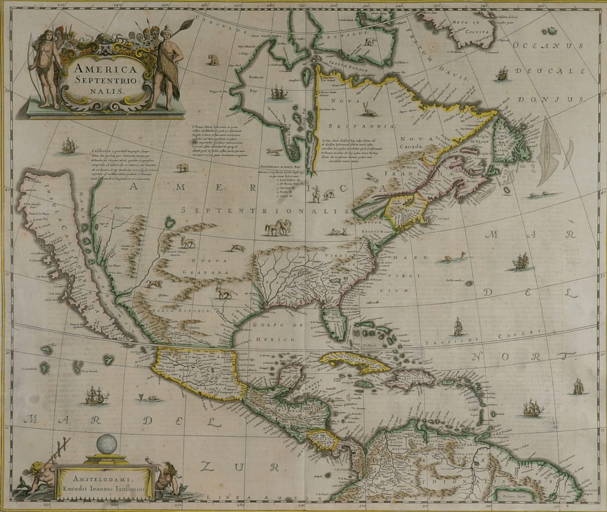
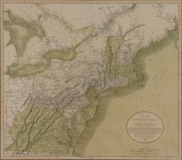
- J. Jansson/H. Hondius
- America Septentrionalis, 1636-1641
- Paper
- 21.5 x 18.25 in
America Septentrionalis is the first separate Dutch atlas map of North America. The map displays what is now North America, Central America, and part of South America. California is depicted as an island and there are small drawings of various animals across the continents. Only one of the Great Lakes is shown – Lac des Iroquis and the map has light coloring. The title is in the top left corner, surrounded on either side by people holding various weapons. In the bottom left corner is a table with the words “Amstelodami, Excudit Ioannes Ianßonius” written on a hanging sheet. There is a globe on top of the table and a mermaid is on either side.
- Subject Matter: Map
- Current Location: Floor 1 - Taft Map Room 108
- Collections: Maps
Other Work From The Supreme Court of Ohio