The Supreme Court of Ohio
Columbus, OH
An organized archive and digital exhibition of the art located within the Thomas J. Moyer Ohio Judicial Center.
Message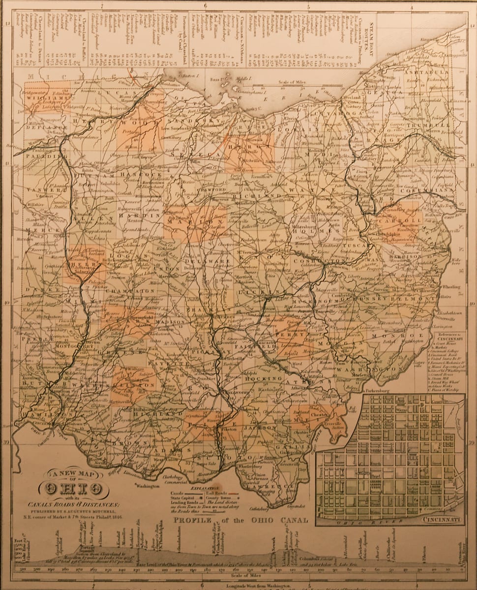
- Samuel Augustus Mitchell
- New Map of Ohio, 1846
- Paper
This map depicts Ohio in 1846. “A New Map of Ohio with its Canals Roads & Distances: Published by S. Augustus Mitchell, N.E. corner of Market & 7[6] Streets Philad [2/3] 1846” is written in the bottom left.
- Subject Matter: Map
- Current Location: Floor 1 - Taft Map Room 108
- Collections: Maps
Other Work From The Supreme Court of Ohio