The Supreme Court of Ohio
Columbus, OH
An organized archive and digital exhibition of the art located within the Thomas J. Moyer Ohio Judicial Center.
Message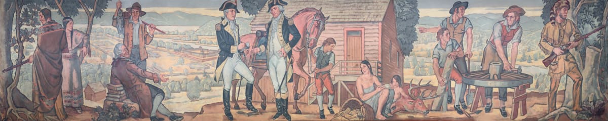
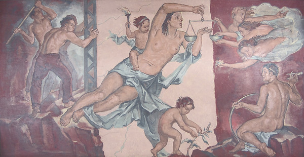
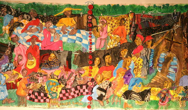
- Rudolph Scheffler
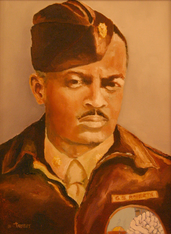
- Courtroom Panoramic Mural I
- Paint on Wall
Just beneath the courtroom ceiling, 15 murals illustrate significant milestones in Ohio history.
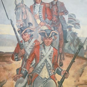
The first panel is the 1788 The Settlement of Marietta. The largest historical painting in the room, located on the rear wall of the Courtroom and facing the bench, honors the founders of Marietta—the first settlement established by the Ohio Company of Associates in the Northwest Territory. The company’s investors named the community after Marie Antoinette, wife of Louis XVI and queen of France, to honor her country’s contribution to the colonists’ victory in the American Revolution. The Northwest Territory’s first governor, Arthur St. Clair, settled in Marietta in 1788. Because of its prime location along the Ohio River, Marietta grew quickly and became a vital trading center for the Northwest Territory and eventually for the state of Ohio. The panoramic painting of the settlement features 13 figures representing the original 13 colonies. In the central foreground, Rufus Putnam, one of the founders of the Ohio Company, confers with St. Clair.
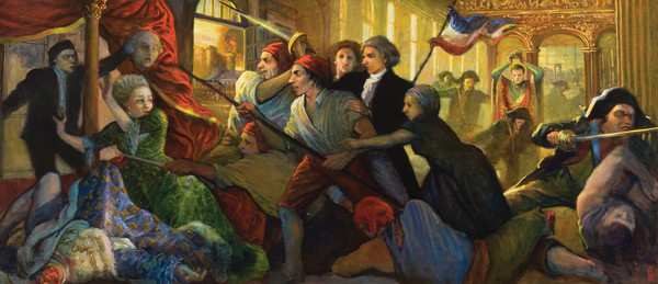
In the second panel, Céleron de Bienville takes possession of the territory now known as Ohio, burying leaden tablets in the Ohio River. In the summer of 1749, Celeron (or Celoron) de Bienville of France traveled from Montreal to the headwaters of the Ohio River (present-day Pittsburgh) and proceeded down the river. He carried with him several lead plates with French pronouncements that lay claim to the Ohio Country. After burying a tablet at every major river confluence, he hung a metal plaque on nearby trees declaring the tablets’ presence.
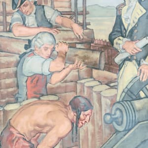
In the third panel, Christopher Gist builds forts along the Ohio and Scioto Rivers for the British. Christopher Gist provided England and its colonists with the first detailed description of southern Ohio and northeastern Kentucky. Born in Maryland in 1706, Gist moved to northern North Carolina along the Yadkin River by 1750 when the Ohio Company chose him to survey along the Ohio River from its headwaters near Shannopin’s Town, Pa., to current-day Louisville, Ky.
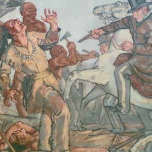
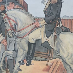
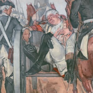
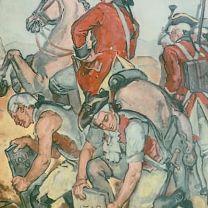
The fourth panel depicts 1755 Braddock’s Retreat. The event depicted here, more accurately called Braddock’s Defeat, was a major victory by American Indians and their French allies over English and Colonial forces during the French and Indian War. Of the 1,400 English men involved in the battle, fewer than 500 escaped alive and unwounded. Mortally wounded, Braddock died four days after the battle. While the English lost this early skirmish, they eventually won the war, driving the French from North America.
The fifth panel depicts Washington raising the British flag at Fort Duquesne. The theme of this mural is largely symbolic. While George Washington was part of an attempt to capture Fort Duquesne from the French, the effort was unsuccessful, and the scene depicted here never occurred. The French also captured several other English settlements in western Pennsylvania. France seized the land claimed by the English and their colonists, which eventually led to the French and Indian War from 1756 to 1763.
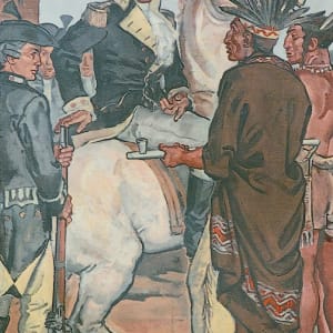
The sixth panel depicts the 1764 Treaty with Chief Pontiac. After waging a series of attacks against English settlements in the Ohio Country in 1763, Pontiac, chief of the Ottawa Indians, ended his rebellion in late 1764. He did not formally surrender to the English (the scene depicted here) until July 1766.
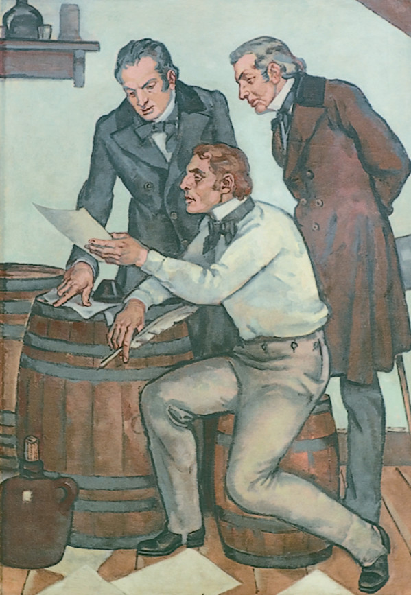
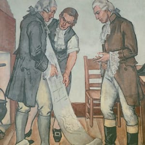
The seventh panel depicts Manasseh Cutler's plans to establish schools and churches in Ohio. Manasseh Cutler secured from the Confederation Congress the right to purchase up to 1.5 million acres in Marietta for roughly 8 cents an acre. Cutler and the first group of settlers to Ohio in April 1788 established the type of schools and churches usually associated with New England towns. In the scene depicted here, Cutler visits the settlement.
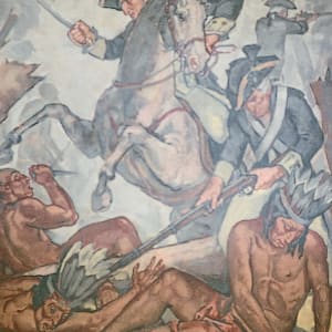
The eighth panel shows the 1794 The Battle of Fallen Timbers. This panel depicts a battle between American Indians and the U.S. Army of the Northwest, led by Commander Anthony Wayne, which took place near the Maumee River. The fight became known as the Battle of Fallen Timbers because a tornado knocked down many of the nearby trees.
The ninths panel is the 1796 The Evacuation of Detroit. The first wall panel on the northeast side of the red curtain shows the Americans taking Fort Detroit from the British. The fort was built in 1701 by the French, who hoped to use it to befriend the Native Americans in the Ohio Valley and protect their interests in the region from the British. They surrendered the fort to the British in 1760 as a result of the French and Indian War. Today, the city of Detroit is located where the fort once stood.
The tenth panel depicts the death of Tecumseh. During the War of 1812, Tecumseh and his followers allied themselves with the British, hoping an English victory would result in a return of the Indian homelands. British troops, however, deserted Tecumseh and his men during the Battle of the Thames, leaving many, including Tecumseh, to die at the hands of American Army troops led by William Henry Harrison.
The eleventh panel shows Commodore Perry’s victory on Lake Erie in 1813. This panel depicts Oliver Hazard Perry’s victory over the British on Lake Erie, ensuring American control of the Great Lakes after the War of 1812.
The twelfth panel depicts the 1816 establishment of state government in Columbus. Chillicothe served as the first capital of the new state of Ohio from 1803 until 1810, when the legislature moved the capital to Zanesville. It then was shuttled back to Chillicothe in 1812, while the legislature searched for a more centralized location. As depicted in the panel, Columbus became Ohio’s permanent capital in 1816.
The thirteenth panel depicts the opening of the Ohio & Erie Canal in 1832. Construction on the 309-mile Ohio & Erie Canal, built to connect the Ohio River at Portsmouth and Lake Erie, began in 1825. The canal had to be at least 4-feet deep, 26- feet wide at the bottom and 40-feet wide at the top. Although it operated into the 1870s, most areas of the canal were not in use near the end because of the high costs of maintaining them. In 1913, a flood destroyed those parts of the canal still in use.
The fourteenth panel depicts the departure of the last Native Americans for the reservations in 1841. With the signing of the Treaty of Greenville in 1795, most American Indians living in the Ohio Territory surrendered their land to the federal government and moved to reservations in the northwest part of the territory. Starting in 1818, the Miami Indians were forced out of Ohio into Indiana, then into Kansas and eventually into Oklahoma. The Delaware Indians left for Kansas in 1829. In the 1830s, the Mingo, Ottawa, Shawnee, and Kaskaskia were forced to Kansas, and Oklahoma. Last to leave were the Wyandot, who left their reservation near Upper Sandusky and proceeded on foot to the Ohio River, making their way west by steamboat.
The fifteenth panel shows the 1863 defeat of the Confederate cavalry by General John Morgan at Buffington. This panel commemorates the only Civil War battle fought in Ohio. In 1863, Confederate cavalry commander John Hunt Morgan led a group of about 2,500 Confederate soldiers from Kentucky into Indiana and then Ohio, pillaging towns and villages along the way. The federal army pursued them across southern Ohio, and eventually caught up with them at Buffington Island in Meigs County. About 700 of Morgan’s men were captured, but Morgan and the rest escaped and headed north. They made their way up to West Point near East Liverpool, where Morgan was finally forced to surrender.
Other Work From The Supreme Court of Ohio