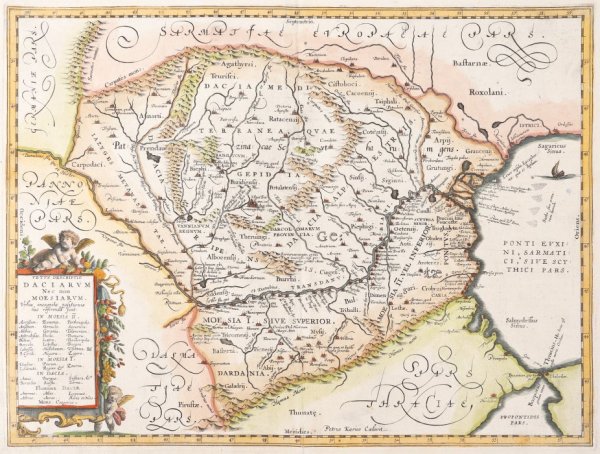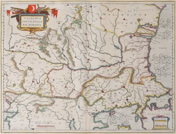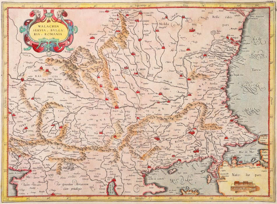
- Gerardus Mercator
- Wallachia, Serbia, Bulgaria, Romania, Amsterdam (2nd pcs), 1589
- Copper engraving, laid paper, hand-coloured
- 35 x 47 cm
-
Available
The board represents the northern part of the Balkan Peninsula and is made by Mercator and was published in the year 1589. After the death of Gerardus Mercator, most of the etching plates used for making the maps in the atlases were purchased by the Hondius family, among these being also the plate for this map. Thus, the map shall be edited and intensively multiplied both by the Hondius publishing house and the Bleau family, in a slightly different representation. The map also contains a cartouche with stylized geometrical elements, in the upper left part under the form of two face-to-face lion heads which hold in their teeth a string which seems to keep a massive iron frog closed. The string is passing through the closing holes and has tassels at its end. The maps' content is framed by a grid with meridians and parallels, and, in the lower right part a graphic scale is presented in Italian miles.
- Collections: Maps, Old Maps, Romanian Maps
Other Work From M Art Museum