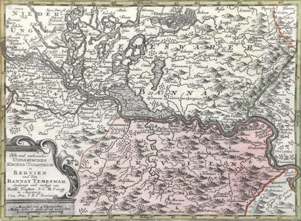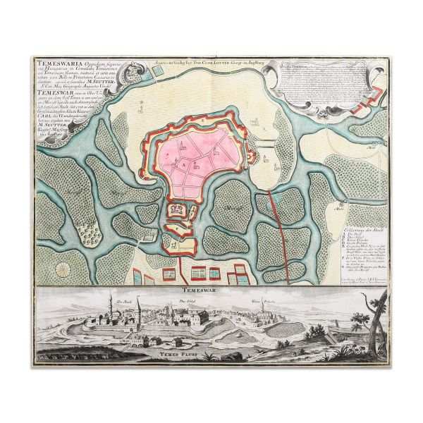
- Matthaus Seutter
- Map of the Timisoara fortress, 1745
- Copper engraving, laid paper, hand-coloured
- 53 x 64 cm
-
Available
Temeswaria Oppidum superioris Hungarice, art of the Timișoara citadel, with the fortification plan and overview of the city. Executed by Matthias Seutter in 1745, hand colored in period.
The map comes framed in a contemporary frame.
- Collections: Maps, Old Maps, Romanian Maps
Other Work From M Art Museum