Leah Wilson
Eugene, Oregon
Place-specific visual artist interweaving art with physical engagement with the environment, keen observation, and a curiosity toward scientific research
Message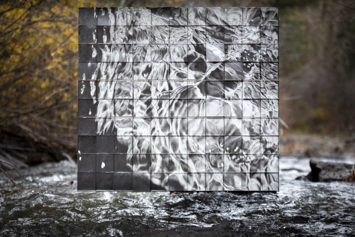
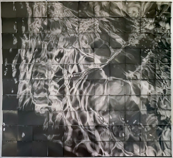
At Pine Meadow Ranch, a working ranch in Sisters, Oregon I studied old water rights maps, learned about the dams and irrigation diversions, and spoke with scientists and restoration organizers. Each of these stories contained elements of division, fragmentation, and sectioning: Water rights maps divide the water conceptually into grids, dams physically segment and fragment the creek and its flow, and scientists and conservationists segment and isolate sections for manageable research and restoration.
I found a piece of old fencing grid in the ranch’s ‘boneyard.’ It came into the studio and informed the structure of the drawing. The grid resonated with me because of the stories of the creek’s fragmentation.
I cut 4×4 inch pieces of Dura-Lar to fit within each fencing grid segment. The drawing progressed square by square. Each square was isolated from the others as I worked on it. Each segment is a separate drawing and has its own line quality and relationship to its borders. After each square was drawn, it was tied to the grid to unite the existing fragments.
Once I finished the drawing, I returned to photograph the drawing at Whychus Creek to have the drawing and the creek interact.
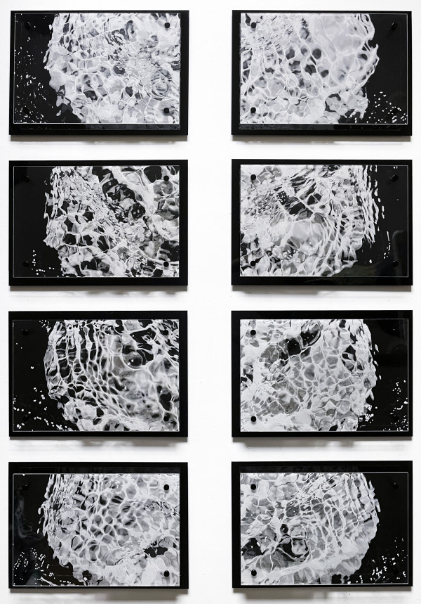
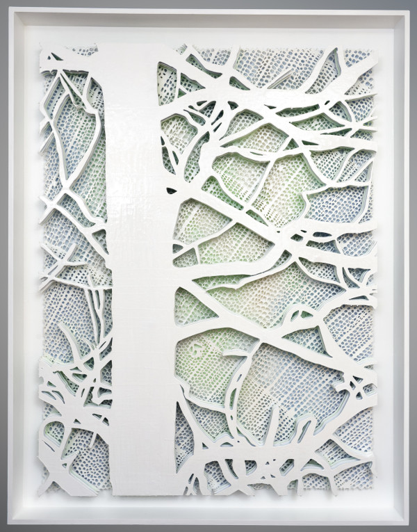
Other Work From Leah Wilson