Portfolio
About
Collections
Artists
Log In
Discovery
TIMELINES ANTIQUES
Saint Paul, MN
Message
Portfolio
About
Collections
Artists
All
Available
Sold
Collection: MAPS
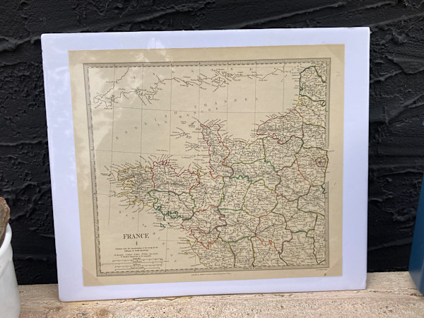
SHRINKWRAPPED early 1830 map of NW France
13 x 15 in
(33.02 x 38.1 cm)
$110
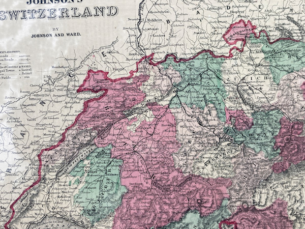
SHRINKWRAPPED early 1864 map of Switzerland
13.5 x 18 in
(34.29 x 45.72 cm)
$110
SHRINKWRAPPED early 1864 map of Canada
26.25 x 18 in
(66.68 x 45.72 cm)
$135
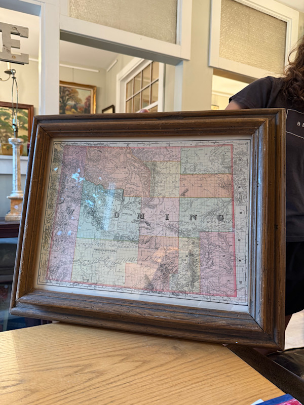
early 1891 map of Territory of Wyoming
14.5 x 21.5 in
(36.83 x 54.61 cm)
$135
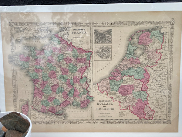
SHRINKWRAPPED early 1864 map of France, Holland...
18 x 26 in
(45.72 x 66.04 cm)
$150
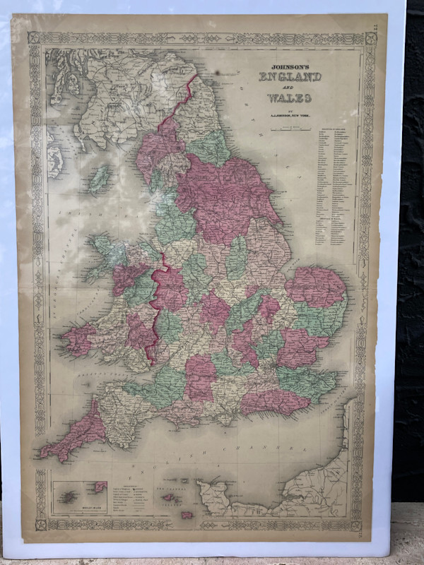
SHRINKWRAPPED early 1863 map of England and Wales
26.25 x 17.5 in
(66.68 x 44.45 cm)
$150
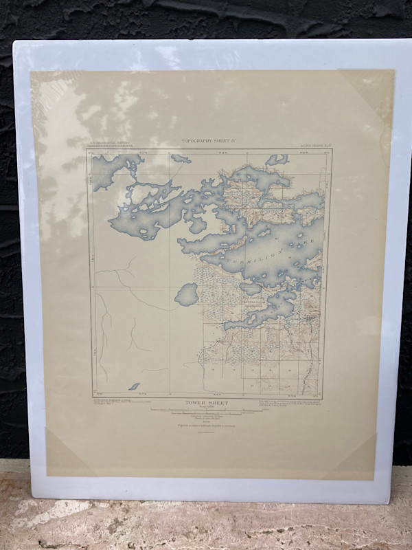
SHRINKWRAPPED early 1903 map of Lake Vermilion
18 x 21 in
(45.72 x 53.34 cm)
$110
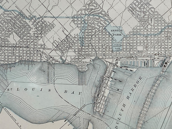
SHRINKWRAPPED early 1892 map of Duluth
14 x 21 in
(35.56 x 53.34 cm)
$110
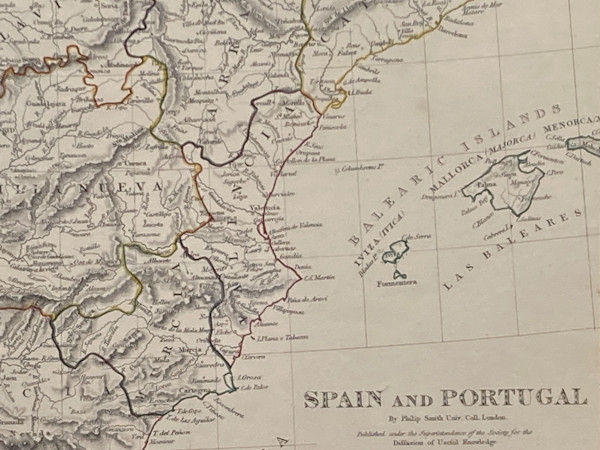
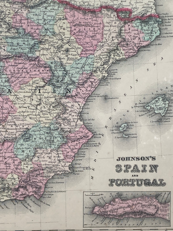
SHRINKWRAPPED early 1861 map of Spain and Portugal
14 x 18.5 in
(35.56 x 46.99 cm)
$110
SHRINKWRAPPED early 1838 map of Spain and Portugal
14 x 18.5 in
(35.56 x 46.99 cm)
$135
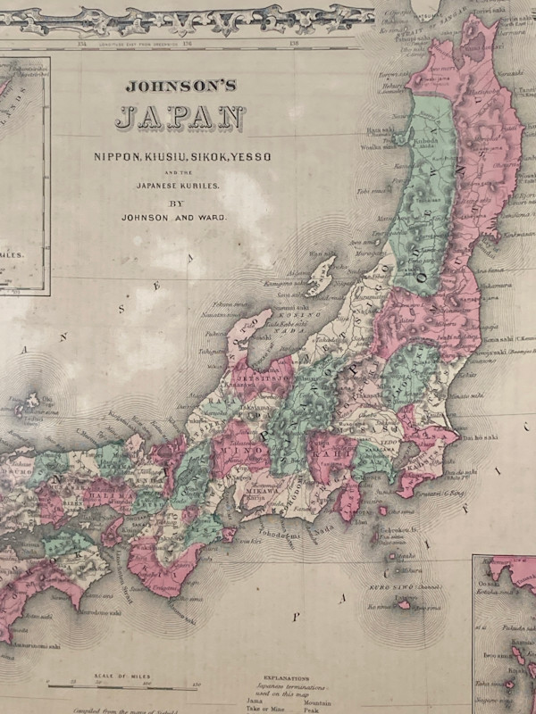
SHRINKWRAPPED early 1863 map of Japan
14 x 19.5 in
(35.56 x 49.53 cm)
$135
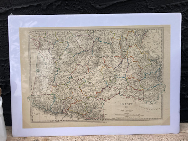
SHRINKWRAPPED early southern France Map 1830's
12 x 17.5 in
(30.48 x 44.45 cm)
$100
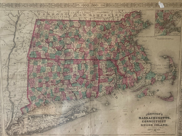
SHRINKWRAPPED 1864 map of Massachusetts
18 x 26 in
(45.72 x 66.04 cm)
$150
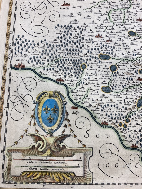
Framed 17th century map Jan Jansson
22.25 x 26.25 in
(56.52 x 66.68 cm)
$325
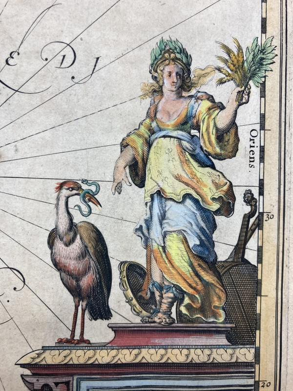
Framed 17th century map by Jan Jansson
22.25 x 26.25 in
(56.52 x 66.68 cm)
$325
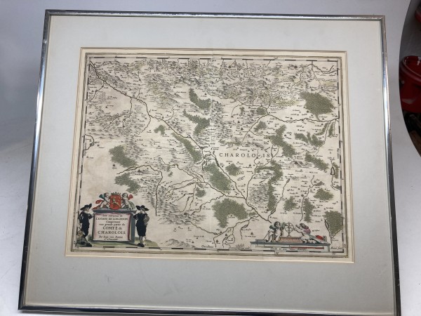
Framed 17th century map by Joan Blaeu
22.25 x 26.25 in
(56.52 x 66.68 cm)
$325