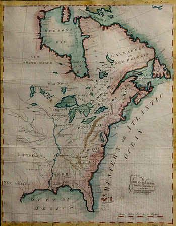
- Artist Unknown
- The United States of America and the British Territories, c. Early 1800s
- Ink on paper
- Framed: 15 x 13 in (38.1 x 33.02 cm)
Thank you to Dr. Glen Gabert for the generous donation of this map. The map was probably created in the early 1800s.
- Current Location: STEM (Science, Technology, Engineering, and Mathematics), 263 Academy Street - 2nd Floor Lobby
- Collections: American Political Culture, Drawing, Natural Landscape and Urban Landscape, Nineteenth Century and Before
Other Work From Hudson County Community College