• Portfolio
  • About
  • Collections
  • Log In
Artwork Archive Logo
  • Discovery
Shanti Conlan

Shanti Conlan

Houston, TX

Message
  • Portfolio
  • About
  • Collections
  • Shanti Conlan
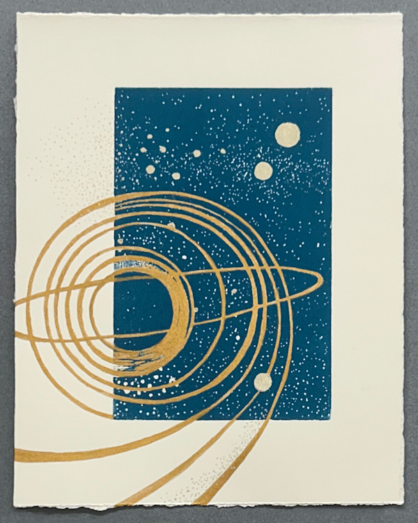
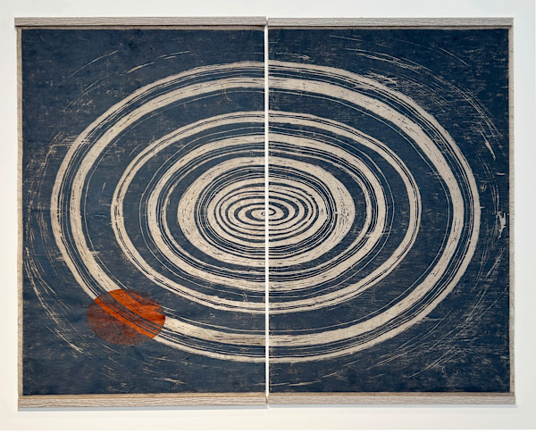
  • Marshallese Navigation Chart IV
  • Woodcut, Carborundum print, Chine Collé
  • 9 x 6 in
  • Paper size: 12 x 9 in
  • Framed: 16 x 12 in
  • Edition 1/3
  • $950
  • From Marshallese Navigation Chart IV
  • Inquire
  • Purchase
  • Share
  • Facebook logo facebook Share this blog post via Facebook
  • Twitter logo twitter Share this blog post via Twitter
  • LinkedIn logo linkedin Share blog post via LinkedIn
  • Email logo email Share this blog post via email
Prev
Next

Woodcut printed on kozo paper chine collé over carborundum print, on rag paper. Imagery is a segment of a Marshallese Meddo Chart, a navigation tool used to describe the locations of islands and ocean currents. Created from palm and coconut fibers and cowry shells, the maps were studied and shared prior to journeys and aided the Marshallese people in journeying the often extreme distances between atolls in the island group. This series of five images is called "How to Get Home" and is homage to my birthplace of Majuro, which I left as an infant. I have no conscious memory of the place, but carry it as part of my heritage.
Other Work From Shanti Conlan

Island 1/3 by Shanti Conlan
Island 1/3
Overgrowth 1/3 by Shanti Conlan
Overgrowth 1/3
Channel 1/3 by Shanti Conlan
Channel 1/3
Marshallese Navigation Chart II 1/3 by Shanti Conlan
Marshallese Navigation Chart II 1/3
Pathway V by Shanti Conlan
Pathway V
Solstice Path VI by Shanti Conlan
Solstice Path VI
North Sea Variation III by Shanti Conlan
North Sea Variation III
Pathway VI by Shanti Conlan
Pathway VI
North Sea Variation I by Shanti Conlan
North Sea Variation I
Solstice Path V by Shanti Conlan
Solstice Path V
See all artwork from Shanti Conlan
 

© 2025 Shanti Conlan & Spire Studio, LLC. All rights reserved

Powered by Artwork Archive