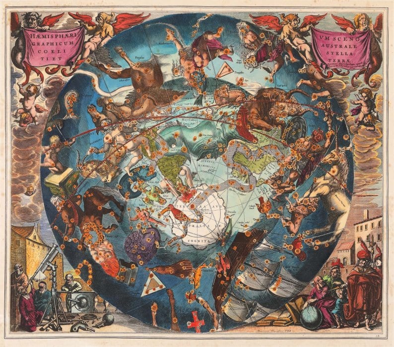
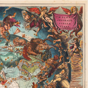
- Henricus Hondius
- Haemisphaerium Scenographicum Australe Coeli Stellati Et Terrae, Celestial map, Amsterdam, 1661
- Copper engraving, laid paper, hand-coloured
- 49 x 61 cm
-
Installed
A celestial map made by the engraver Henricus Hondiu, which illustrates the constellations in the southern hemisphere overlapped to the southern polar hemisphere, published for the first time by the cartographer Andreas Cellarius, in 1660. The map presents an impressive picture of the stars, as if seen from the depth of the Cosmos, so that every constellation is oriented to the opposite direction compared to the way the same constellations would be seen from the Earth. This projection reflects a theory of Petrus Plancius according to which stars have remained in a configuration similar to a sphere over the Earth, which moved along with the Earth. This theory can be found in his atlas's title, Harmonia Macrocosmica. Andreas Cellarius was born in 1596 in Neuhausen and studied at Heidelberg. He emigrated in The Netherlands at the beginning of the 17th century and, in 1637, moved to Hoorn, where he became the rector of the Latin School. The most known work of Cellarius is Harmonia Macrocosmica, first published in 1660 by Jan Jansson, as an addition to Atlas Novus of Jansson. The work consists of a series of celestial maps started by Cellarius in 1647 and intended as part of a treaty about cosmography, in two volumes, which was never published. The maps of Cellarius are the most wanted celestial maps, as they combine the stunning images of the golden age of the cartography in the Netherlands with contemporary scientific knowledge.
Other Work From M Art Museum