

- Johannes Sünnecke
- Karl Schilling
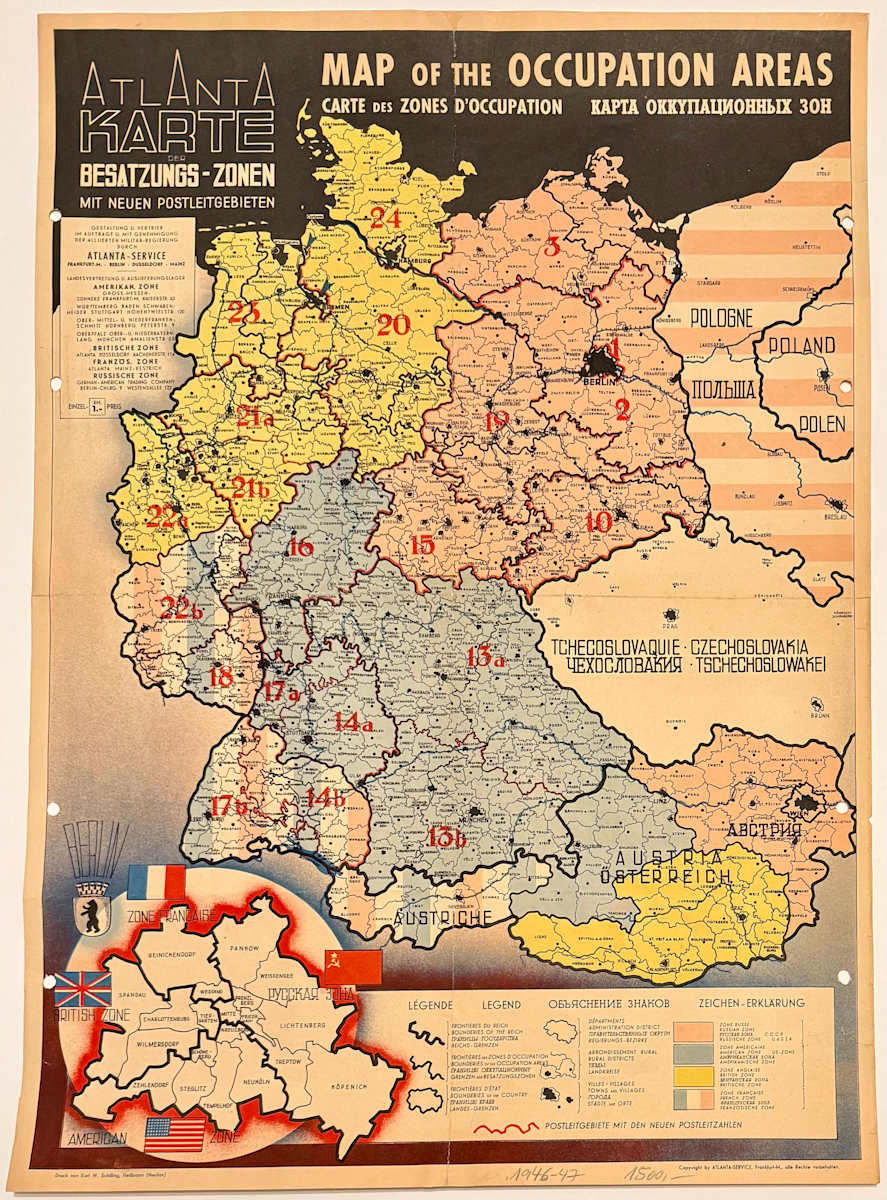
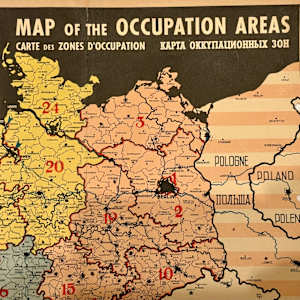
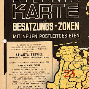
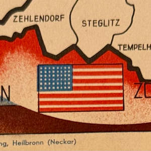
- Map (Atlanta Karte der Besatzungs-Zonen), c. 1946
- Color Lithograph
- 20.75 x 14.5 in
- Framed: 26 x 19.75 x 0.75 in
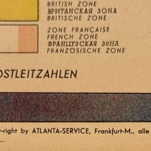
- Signature: "Druck von Karl W. Schilling, Heilbronn (Neckar)" printed lower left-hand corner "Copy-right by ATLANTA-SERVICE, Frankfurt-M., alle Rechte vorbehalten." printed lower right-hand corner
-
Not For Sale
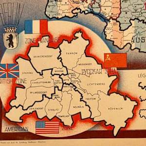
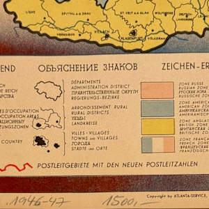
Map of the Occupation Areas - This map was created in three languages; English, French and Russian. This is the English version.
A map of Germany and Austria shortly after the end of the Second World War. The map shows the partition of defeated Germany and Austria into French, British, American and Russian occupation zones, as agreed at the Potsdam Conference in August 1945 and earlier in principle at Yalta, with an inset showing the division of Berlin. The Russian zones are marked in pink, the American blue, the British yellow, and the French red, white & blue stripes. To the east Poland is shown with its new borders shifted to the west and colored with pink stripes, presumably a reference to Russian influence or occupation. The map has a cover price of one Reichsmark, the currency of Germany between 1924 and 1948, when it was replaced by the Deutschmark. The map includes much detail including the new postal districts and codes introduced by the Allies after the war.
- Subject Matter: Map
Other Work From Mike Woginrich