Guild of Natural Science Illustrators
The GNSI is a 501(c)(3) that connects, provides professional development & networking opportunities to visual science communicators
Message55th Anniversary Juried Member's Exhibit - 2023
- August 11, 2023
- Exhibition
- /
- Artwork
- /
- Artists
Online Exhibition
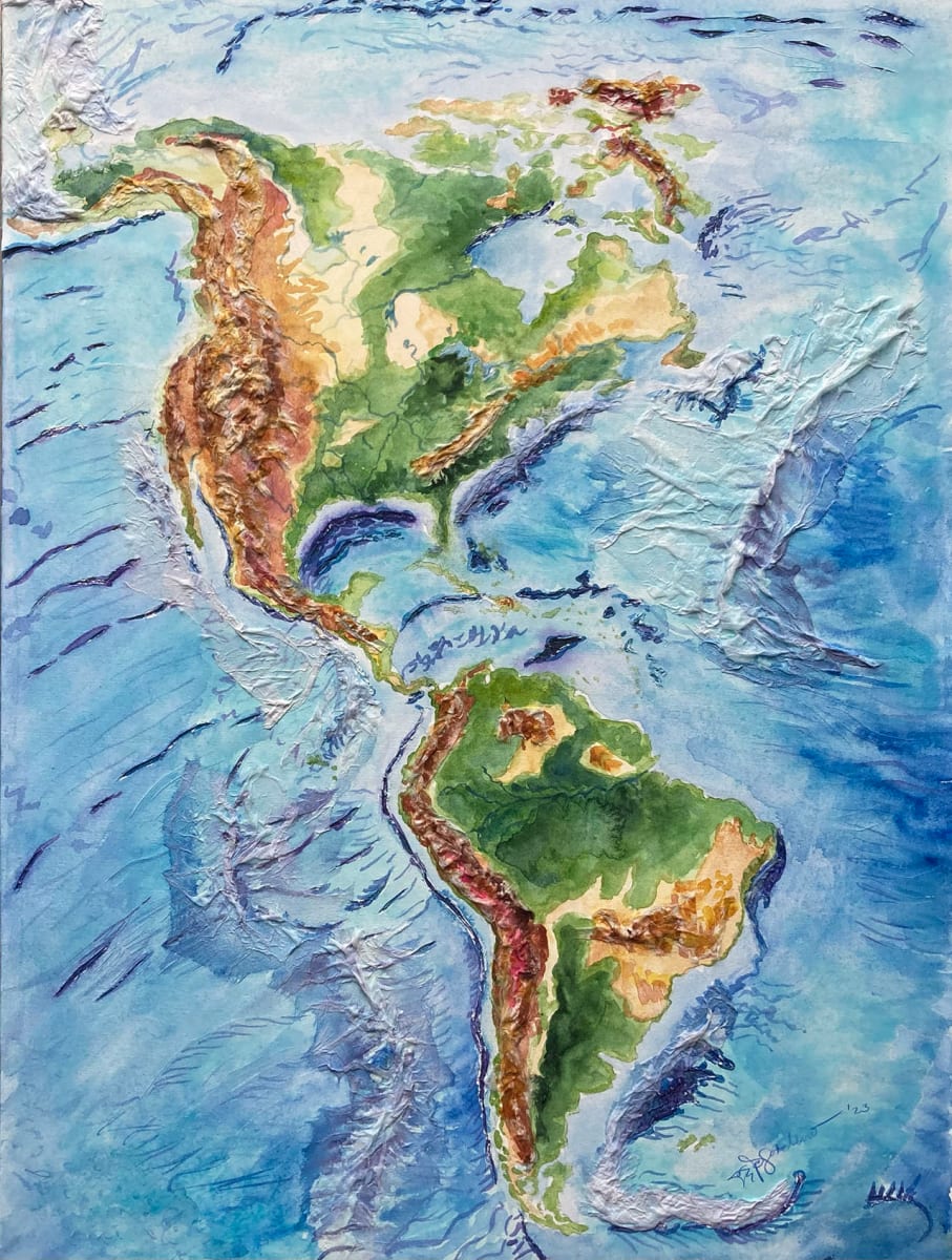
Map of the Elevations of North and South America
- Watercolor, Tengucho Paper, Yes Archival Glue
- 36 x 24 in
- Mariah Sotelino
Multi-media textural rendering using watercolor and tengucho paper (mulberry fiber) of the ETOPO1 bedrock elevation data by Kevin Gill. Major rivers of North and South America are depicted to add further elements of ridges and valleys. Burnt sienna represents the highest elevations, tan medium elevations, and green the lowest land elevations. Indigo blue represents the deepest caverns on the ocean floor, the lighter blues medium, and the lavender oceanic ridges that correlate with continental borders.
- Subject Matter: Geography