Guild of Natural Science Illustrators
The GNSI is a 501(c)(3) that connects, provides professional development & networking opportunities to visual science communicators
Message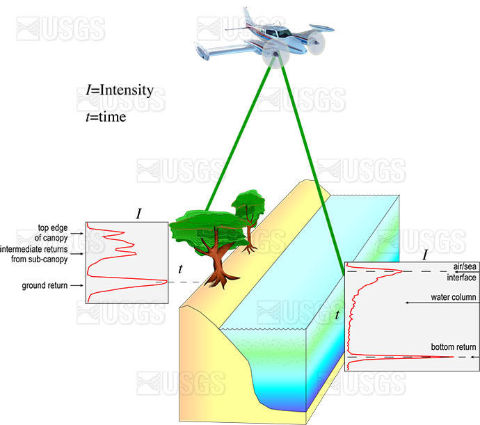
- Betsy Boynton
- lidar sensor captures time-resolved data
- Vector Art
EAARL lidar figure used in multiple reports and poster sessions. The EAARL sensor captures time-resolved information about the entire returned laser waveform.
First published in:
Crane, M., Clayton, T., Raabe, E., Stoker, J., Handley, L., Bawden, G., Morgan, K., and Queija, V., 2004, Report of the U.S. Geological Survey Lidar workshop sponsored by the Land Remote Sensing Program and held in St. Petersburg, FL, November 2002: US Geological Survey Open-File Report 2004–1456, 72 p.