Guild of Natural Science Illustrators
The GNSI is a 501(c)(3) that connects, provides professional development & networking opportunities to visual science communicators
Message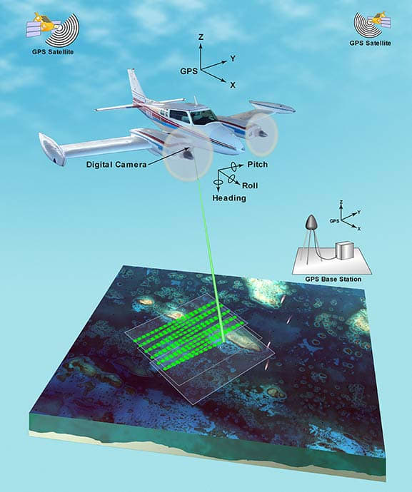
Lidar illustration shows plane and equipment
- Vector Art
- Betsy Boynton
This lidar illustration depicting plane and equipment setup has been used in many publications and websites. This illustration depicts the equipment used, including the plane with digital camera mounted underneath, and the GPS base station, but does not show the satellites used to obtain the coordinates. The original version had a white background.
Airborne lidar is a surveying method that measures distance to a target from a survey plane by illuminating that target with a pulsed laser light, and measuring the reflected pulses with a sensor. Differences in laser return times and wavelengths can then be used to make digital 3D-representations of the target.