Guild of Natural Science Illustrators
The GNSI is a 501(c)(3) that connects, provides professional development & networking opportunities to visual science communicators
Message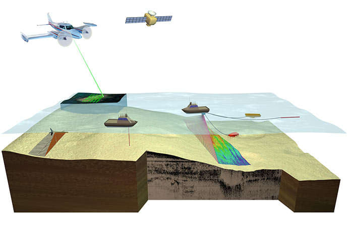
- Betsy Boynton
- Basic types of remote sensing technologies
- Vector Art
Figure 1. Diagram illustrating basic types of remote sensing technologies with application to benthic habitat mapping. (A) Side-scan sonar; (B) Lidar; (C) Color aerial or satellite imagery; (D) Single-beam sonar; (E) Multibeam or swath sonar; (F) Seismic acquisition; (G) Bottom visualization; (H) water column data collection.
Moses, C.S., Nayegandhi, A., Brock, J., and Beavers, R., 2010, USGS-NPS Servicewide Benthic Mapping Program (SBMP) workshop report: U.S. Geological Survey Open-File Report 2010–1194, 32 p.