Guild of Natural Science Illustrators
The GNSI is a 501(c)(3) that connects, provides professional development & networking opportunities to visual science communicators
Message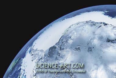
- Theophilus Britt Griswold
- Antarctica from Space
- Color
This image of Antarctica was composited and enhanced in Photoshop from 4 separate satellite data images. This view is not possible to see optically from orbiting spacecraft because of the angle and height this image is rendered to represent. It is a unique view of the most remote continent on Earth. Originally used in a National Geographic Children's Atlas.
- Collections: Astronomy/Space Art, Geology